
Gambleside: The abandoned Rossendale village lost in the 19th Century
This Medieval village was abandoned before the dawn of the 20th Century. What once stood in north Rossendale, and on the shores of the Clow Bridge Reservoir is now almost totally lost to the elements.
The ragged countryside is full of dry stone walls and foliage but amongst the dense green land, a serious of old markers are seen poking from the landscape.These are the remnants of Lancashire's abandoned village: Gambleside, a settlement that was fully abandoned by its residents during the 1890s.
Gambleside started life in the late high Medieval period when it was first mentioned as a vaccary, a type of cow farm, in 1242. It was one of the many vaccaries that populated the Rossendale Forest.
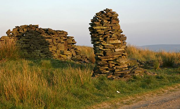 A dry stone pillar left over from Gambleside.
Both the village and the forest were a part of the Honour of Clitheroe. The Honour was an old grouping of manor houses centred on Clitheroe Castle, almost like an organised area before the lines of todays counties were drawn up. At this time the area of Gambleside stretched from Limy Water near Burnley and over the hills into the valley of Whitewell Brook, including land on the southern side of Clough Bottom Reservoir.
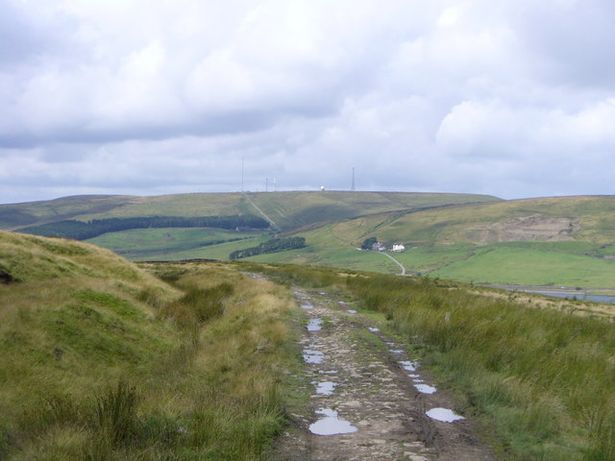 The old track above Clow Bridge Reservoir seen off to the left.
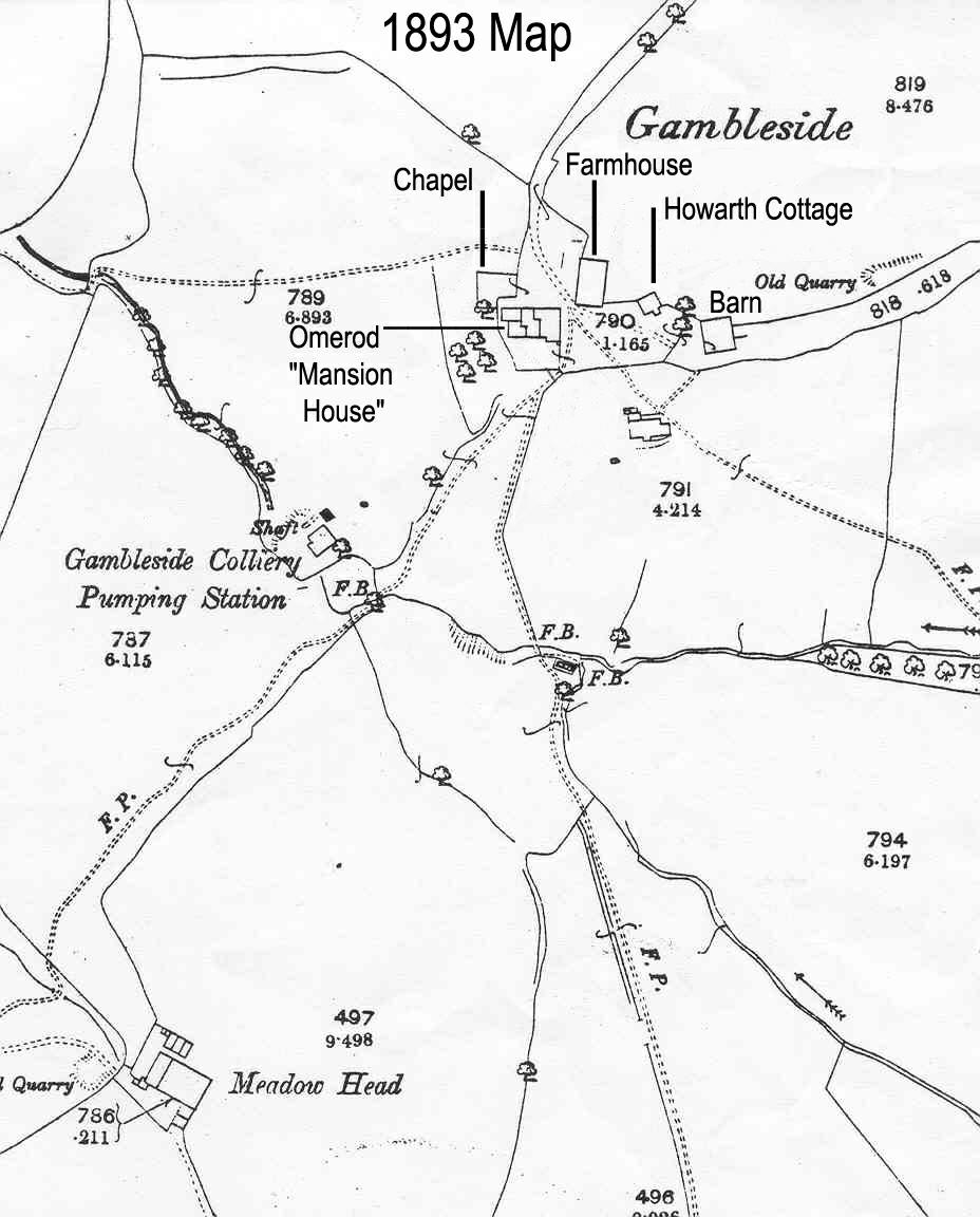
Gambleside was given as a copyhold to Oliver and George Ormerod in 1507 meaning that the land was almost rented by the two men at a price of £4 per year, around £4,400 in today's money. The village was located on a Limersgate, a pathway used by pack horses carrying important exports of lime from Clitheroe into Rochdale.But it really exploded into life in the 17th Century when, in 1602, the Gambleside Colliery was established. Collieries were essentially coal mines and the one at Gambleside operated with a winding shaft on the hillside and a nearby pumping pit.
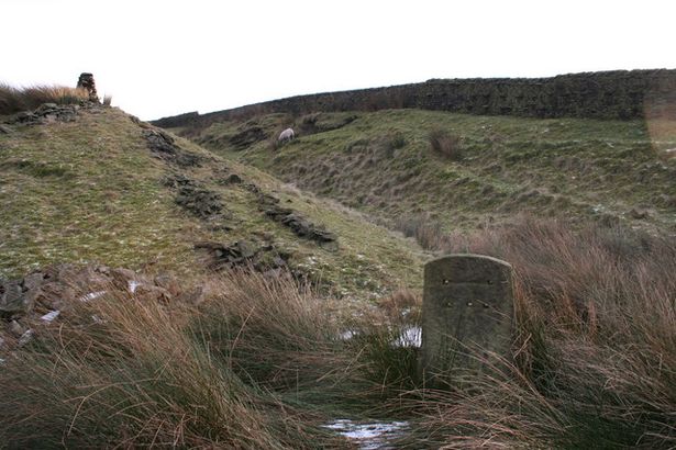 Part of the limersgate at Gambleside.
It's fair to assume that farming began to recede as the men of Gambleside were employed at the colliery which would eventually outlive the village itself, operating until 1936. North West Water still pumps water from the mine workings into the reservoir. In 1866, the construction of the Clow Bridge Reservoir signalled the beginning of the end for Clow Bridge. Reservoirs were built across the rural areas of the north west with the express desire to supply water to the growing urban cities and towns nearby.
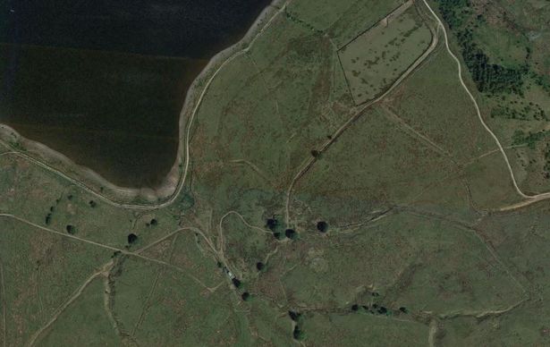 The area next to Clow Bridge where Gambleside once stood.
The reservoir flooded much of the surrounding area, making farming almost impossible and pushing the inhabitants to move away in droves. The Ormerod family still resided in Gambleside, remaining in their family home until 1874 before the village was totally abandoned during the 1890s.
Buildings remained along the reservoir but between 1940 and 1950 they were demolished. However, alongside the Gambleside trail there are still a few relics of Gambleside including a number of boundary markers, stone pillars and Medieval crosses which would have marked the the position of the Western Cross in the 13th Century.
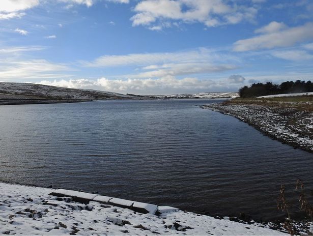 Clow Bridge Reservoir.
There is also an open air baptistry, first built in as part of a Baptist Chapel. Although this has now gone, the open air baptistry was restored by North West Water in 1995. Very few of these structures survive and this really is a fascinating walk through history.
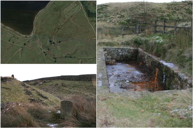 A Bit of Old Gambleside
The following article is believed to have been printed in the Rossendale Free Press on 13 September 1958.
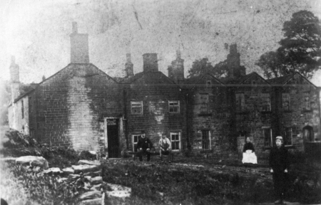 Mansion House
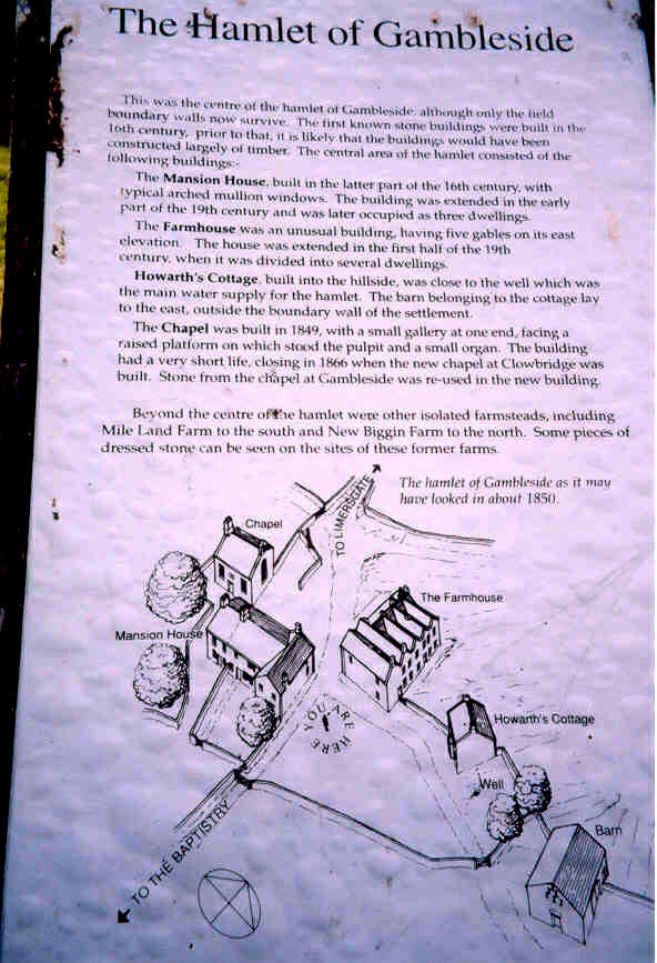
Here is a photograph of a bit of vanished Rossendale - a group of buildings which once stood at Gambleside, beyond Loveclough, It depicts an Elizabethan mansion-house which bore the date stone 1668, and which was pulled down many years ago by the Irwell Valley Water Board when they bought all the land forming the watershed of Clowbridge reservoir.
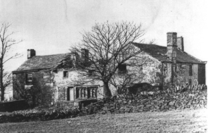 There was a Baptist Chapel, too, to provide for the religious life of the prosperous 18th and 19th century village, and children were taught to read and write at its Sunday school.
The chapel had an open-air font, which still exists, though surrounded by weeds.This was supplied by the brook which feeds the reservoir.The last person to be baptised in it was Mrs. M. M. Ashworth. This was some eighty years or more ago.The chapel was a forerunner of that at Clowbridge.
The country round Gambleside was part of the Forest of Rossendale, which was cleared and divided into vaccaries in the reign of Henry the Eighth.The name Gambleside is probably that of a Danish or Saxon settlement. There were several small farms in the district, and eventually it developed into a biggish village.
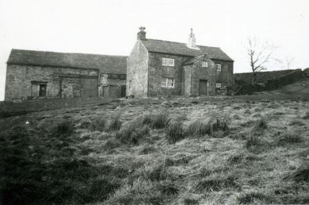
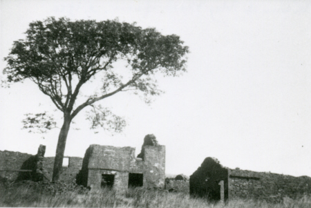
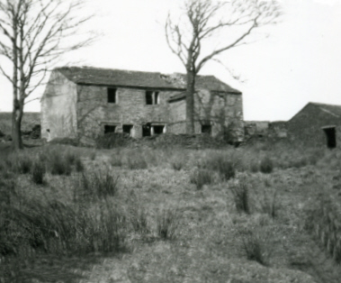
The road from Manchester to Burnley was the old King's Highway over the moors, and this passed through Gambleside. Wool from the sheep kept by the farmers was spun and woven into cloth on handlooms, most of the cloth being used for clothing their own families. One of the farmers, a man named Haworth, used to take some of the surplus cloth to Manchester by horse and cart, bringing back weft and warps for the villagers.
Main crop was oats, and this formed the principal food of the people - many of whom had porridge no less than 24 times a week! One of the first settlers at Gambleside was a John Ormerod, and for 500 years there was a family of that name in the district.
A John Ormerod of Gambleside was one of the first trustees when Goodshaw Church was erected 600 years ago.
 Click to enlarge
Gambleside - A Vanished Village
The following article appeared in the Rossendale Free Press, and was written by Phillip Adkinson, Clowbridge.
It was on Christmas Day 1839 that the officials of the Baptist Church in Clowbridge met and arranged to rent an old house in Gambleside, overlooking the fields where the Clowbridge reservoir is now, as a meeting place for preaching and worship. No official meeting place or church had existed prior to that date and the meetings had been held in the homes of the people.
On the first day of January 1840, when it was bitterly cold with the snow falling, the first meeting in the new building was held. There was no heating in the room and the only seating was on wooden planks covered by sacks provided by the farmer from whom the house was rented. The first congregation consisted of a few farmers, miners and mill operatives. A Sunday school for the children was started at the same place on the same day.It speaks well for the fervour and devotion of these early Baptists that the church grew and prospered in spite of these hardships and in 1843 an old brewhouse was taken over and converted into a chapel.
During these years many baptisms were carried out in a baptismal pit by the chapel. Baptisms were carried out in hot weather when hundreds of people could be seen dotting the hillside leading up from the water.
Others were held in winter when the water was icy and those who had been baptised were doubtless glad to change back into their clothes at one of the neighbouring farms.
The death knell of Gambleside as a community was sounded in 1866 with the completion of the Clowbridge reservoir and the consequent restrictions on farming. It is significant that in November of the same year a schoolroom and dwelling house were opened at Clowbridge "nearer the population" by the Baptists. This building in time took over the functions of Gambleside Chapel.Today, however, there is no longer a chapel at Clowbridge, and apart from a Sunday school which is still held, the building is used as a primary school.
And there is little to show where Gambleside once stood except a few heaps of stones and half dead sycamore trees lining Limey Lane which ran through the hamlet. Yet the fervour displayed there should inspire us all."
Gambleside Colliery
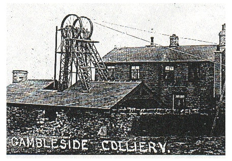 At the end of the last century, there were seven active pits on both sides of the valley, between Loveclough and the crest of the hill beyond the Clowbridge Reservoir.
The earliest pit was at Gambleside, which Court Rolls show was working in 1612. The mine shaft on this site was known as the Pumping Pit, and the pit head was originally level with the top of the bank which surrounds the modern pumphouse.
The Gambleside colliery had two main main shafts - Pumping Pit, located just below the settlement and a later shaft on the hillside to the south. Coal was drawn up the hillside from Pumping Pit by a continuous chain drive of tubs, then passed through a tunnel to Swinshaw Pit on the other side of the hill. From there, it was carried down to the coal staithe at the bottom of Goodshaw Lane in Crawshawbooth.
The Pumping Pit shaft was 122 feet deep and 8 feet in diameter. Men were lowered into the shaft in a tub attached by chains to the winding gear. As there were no guides along the sides of the shaft, the men had to stabilise the tub using sticks if it started to swing.
The 19th century pit head had a boiler house, engine house and winding house, together with an office, workshop and cabin where the men changed before going underground. The remains of the chimney to the boiler house are sited on the far bank of Clowbridge Reservoir.
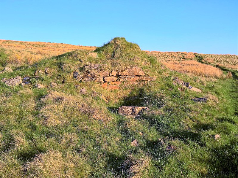
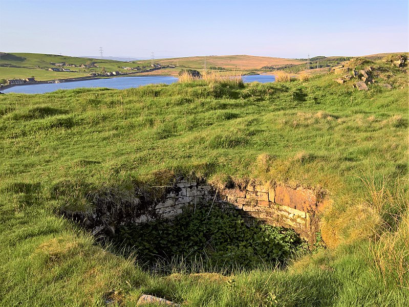 The remains of Gambleside Colliery
©Trappedinburnley
The remains of Gambleside Colliery
©Trappedinburnley
Working conditions were very difficult, as the coal seam was often less than 2'6" high. Young boys called drawers, who were often as young as 6 years old, took the full tubs of coal from the collier to the underground haulage system. The colliers were employed on a piece work basis - when 20 tubs of coal were filled, they could go home, providing the workings had been fully propped.
Pumping Pit, as its name suggests, suffered from water seeping into the mine. It was abandoned early in the 20th century and allowed to become a sump for the rest of the mine. The water from the old workings is now pumped by North West Water, via the modern pumphouse, into the reservoir.
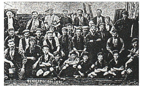
Gambleside Colliery ceased production in 1936 with the closure of its major customer, the Sunnyside Print Works, located opposite the Parish Church in Crawshawbooth. In the days before nationalisation each mine had its own customers.
 ©Trappedinburnley
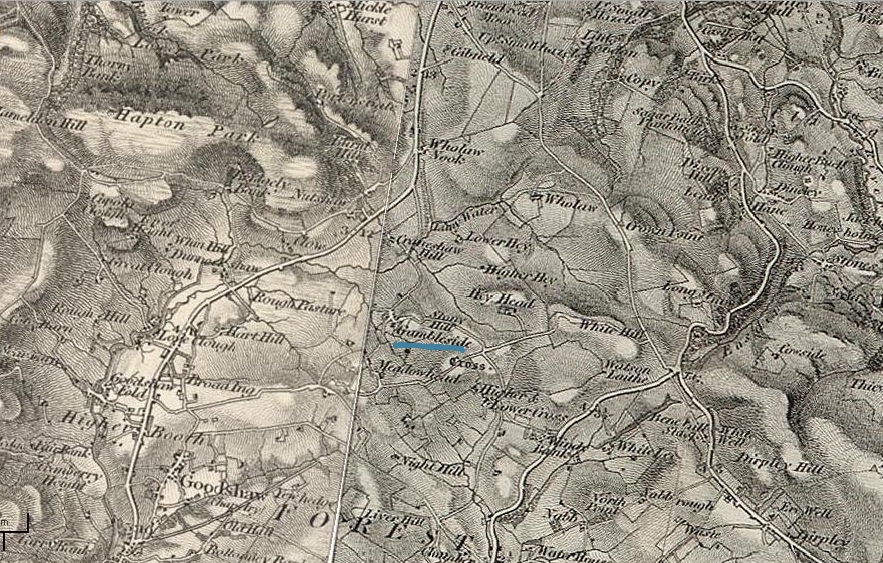
OS map 1869
TOP
Home Page
Welcome Page
 doobydoo@pastechoes.co.uk ©