Stormy Corner
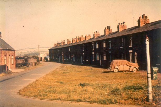
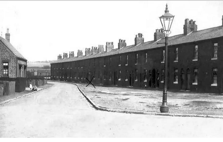
The long lost hamlet of Stormy Corner in Skelmersdale was demolished almost 60 years ago.
An entire village was wiped from the map to make way for development - but then left as wasteland for years. The story of Stormy Corner, a little-known hamlet nine miles west of Wigan, is a sad chapter from the post-war 'New Town' era, in which huge new estates were built to house families from the crowded inner cities.
 click
for big image
click
for big imageIn 1961, the West Lancashire mining village of Skelmersdale was designated as an 'overspill' community for people from Liverpool. The project would spell the end of Stormy Corner, a rural hamlet on its outskirts which dated back to the 19th century, but is remembered by few today.
In its heyday, its cottages were served by shops including Fosters, which sold sweets, Dugdale's grocers, and Drapers, the local Co-op. There was a little school which was disused by the 1950s, two pubs, the Beehive and the Seven Stars, and as typical to an area of West Lancs influenced by the migration of miners from Wales, a Methodist church.
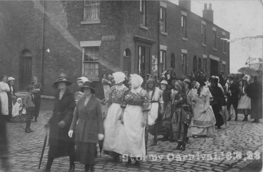 click for larger image
Stormy Corner Carnival 1923
Now all of it is gone, with the Stanley Industrial Estate on the site where the village once stood. The demolition began in 1967, the land earmarked for development as this rural area was transformed by the Skelmersdale New Town project. Writing for the Ormskirk Advertiser in 1969, journalist Clifford Birchall depicted its desolation after the bulldozers first moved in.
He said: "It is easy to tell which houses are occupied in Stormy Corner. Lace curtains hanging at the window distinguish the houses from those which have suffered in the death throes of what may be Skelmersdale's oldest community.
"Stormy Corner today lies executed, its only crime being that it was too old to keep up with the new town of Skelmersdale. A handful of people live there now, the memories of a crowded mining village all the more real as they are recollected in 20th-century silence."
Dawpool
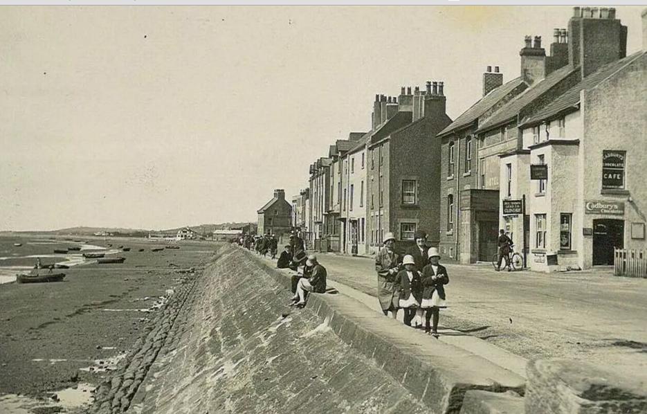 click for larger image
Plenty of walkers but no cars at Parkgate, Wirral, in the early 1900s
In the 18th century, Dawpool would have been a thriving harbour lying between Caldy and Thurstaston. Its prominence dates from the time when it was still possible to navigate the Dee estuary before it silted up,
People across Merseyside know Parkgate for its breathtaking views of the rolling hills of Wales across the River Dee and its famous ice cream shops that come with an extensive range of flavours.Heswall is also known for its strong coffee shop culture, independent shops and restaurants and the town's Poll Hill being the highest point on the Wirral peninsula. However, although these quaint, little town's both share not only the similarities of Welsh views but a historic secret - Smugglers.According to Gavin Chappell, the author of Gavin Chappell Hidden Wirral Myths & Legends , smugglers were a big issue for the small towns. During the 18th century Parkgate had a quay where boats and ships moored with some transporting coal from the nearby Denhall collieries.
The old customs house of Parkgate still stands however is now a private building and oversaw the collection of customs due and sent out patrols to deter smugglers of contraband.As there was only one officer patrolling the Dee for smugglers stationed at Dawpool, the crafty smugglers tried to avoid Parkgate and unloaded cargoes near Heswall and Gayton.
Parkgate was the chief port and the principal terminal for the packet ships travelling back and forth to Dublin. But they also stopped at Dawpool, carrying passengers, newspapers and thousands of pounds worth of cargo decades ago. However, the trade went into decline as the Dee estuary became impassable for shipping and as Liverpool rose to prominence. Today the name of Dawpool is still retained in a number of schools in the Thurstaston area and it also gave its name to Dawpool House, the former residence of the White Star Line shipping owner, Thomas Henry Ismay. The country house itself was demolished in 1927.
The land which Heswall was built on was mainly heath and the area was wild and secluded spots with only a few paths - these parts were shunned by villagers as they were rumoured to be haunted. The earliest reference to smuggling on the Wirral was in the 1584, however it wasn't until the 18th century that the smuggling between the peninsula and the Isle of Man really began to take off.It was Irish packet ships that were the source of the illegal goods entering Parkgate until the 19th century. These were ferry boats that sailed between Parkgate and Dawpool to Dublin, carrying thousands of pounds worth of cargo. The smuggling eventually entered the hands of well-armed men working in gangs, capable of holding their own. At sea the smugglers tended to be sailors or fishermen supplementing their incomes, but on land they were farm labourers who protected the contraband.The forbidden goods for Parkgate, Neston and further inland was unloaded on Heswall or Gayton beach
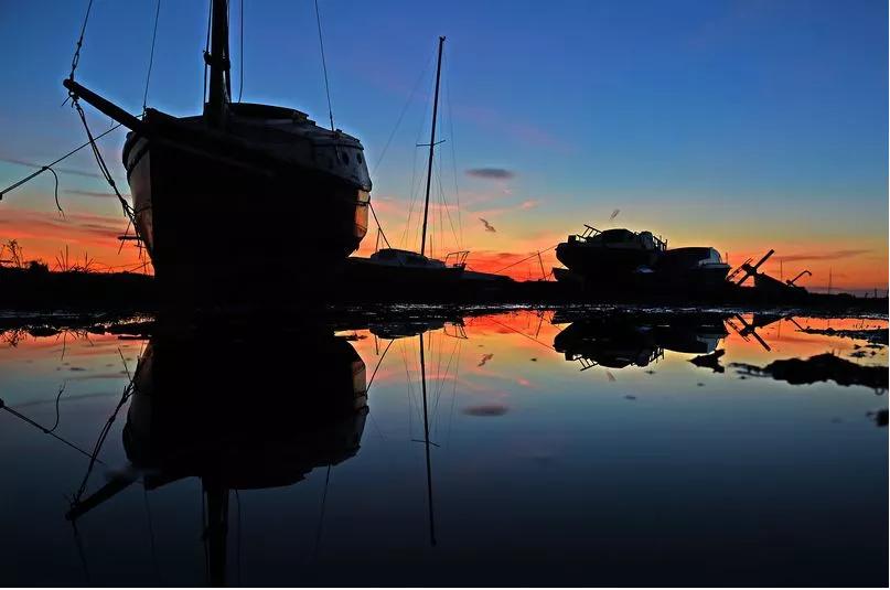
( pic:Sunset at the boatyard in Heswall by Shelldrakes Restaurant.-=click for larger image.)
as it could be easily hidden in woodland. The smaller operations the contraband would be hidden aboard the Irish packet boats , coal sloops heading for Denhall Colliery, cattle boats, or even ships of the Royal Navy. It would then be taken through Heswall where the goods were stored before being transporting them to the purchaser where the sea and land smugglers helped each other with the operation. Eventually these 'dodgy' proceedings stopped and didn't last long into the 19th century, as after the Napoleonic Wars the government stepped in to stop it.
Magazine Village
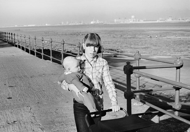
Magazine Village in Wallasey gets its name from the time when it was used to store gunpowder from the sailing ships entering the Mersey for their stay in the Port of Liverpool. The ships were required to unload the powder and have it kept at the Magazines until it was time to sail again.
The explosive material was placed in detached chambers and covered with earth, with a strong wall built to enclose the whole area. But despite these measures, a massive explosion took place in January 1864, when the ship the Lottie Sleigh laden with 11 tons of gunpowder blew up. miraculously there were no deaths, but the explosion caused extensive damage and even shattered windows across Liverpool. As the area became more built-up during the 19th century, concern over the presence of large quantities of gunpowder near residential areas increased, and the store was transferred to floating hulks anchored lower down the river.
The Magazine.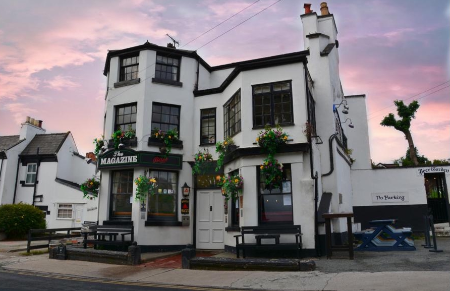
The only reminder of the village now is the name of the local pub, It was built in 1759 for the sailors who had time to spare while they waited for powder to be loaded on to their boats, and is still going strong today.
click for larger image.
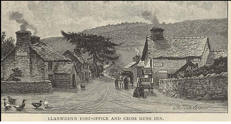
Llanwddyn
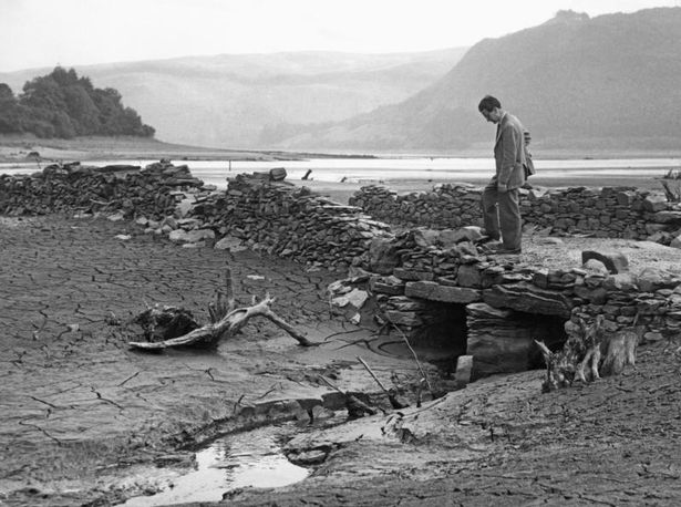
The remains of the village of Llanwddyn emerge from the water for the first time since the village was flooded in 1888
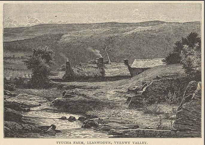
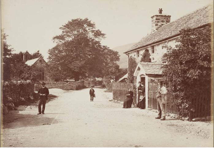
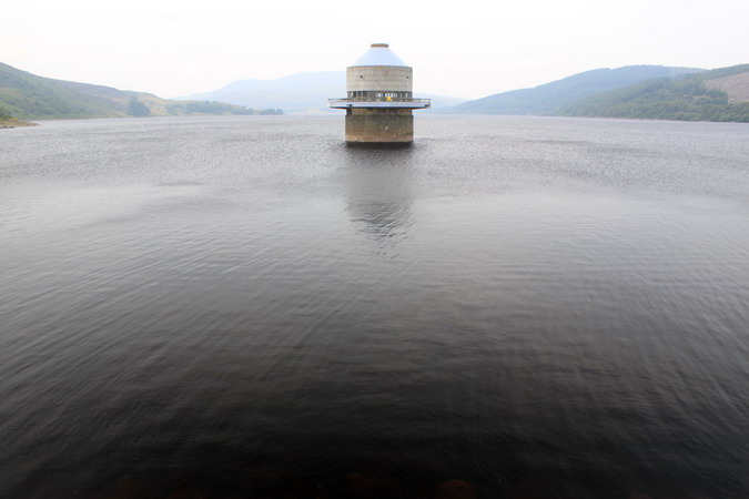
Llanwddyn was once a small village at the head of Vyrnwy Valley in Powys, Wales. But by 1880, the valley had been identified as a suitable site for the reservoir.
Despite opposition from residents of the village, who were not consulted about the proposals, an act was passed and work began the following year to build a dam across the valley. The work took around seven years to complete and in 1888 the old village was demolished and the area flooded.
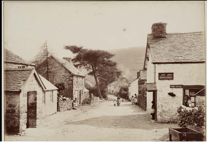
A church, two chapels, three inns, 10 farmhouses and 37 other houses were lost under the rising waters. A new village was built by the Liverpool Corporation around two miles further down the valley, to house the original residents.
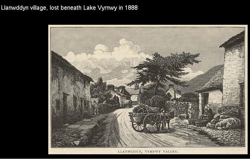
Today the reservoir, called Lake Vyrnwy, is a popular destination for tourists. During a drought season the remains and foundations of the lost village can still be seen.
Capel Celyn
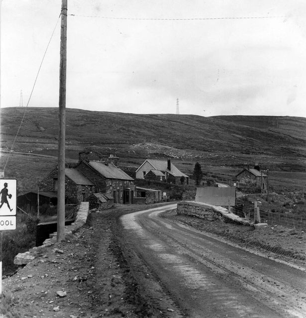
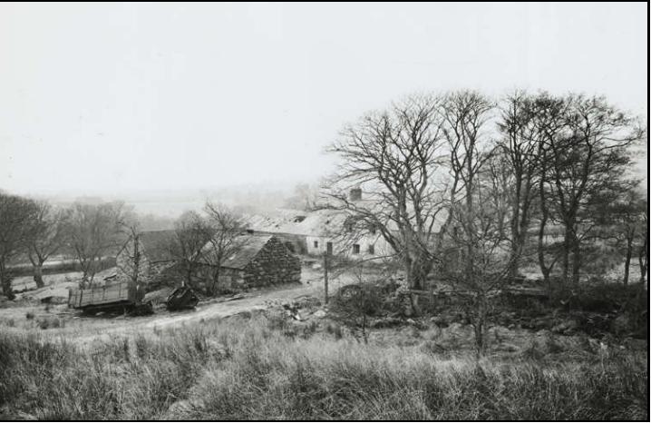
Llanwddyn is not the only welsh village that was submerged to create a reservoir to provide a water supply for Liverpool and Merseyside. Perhaps the most well known is the small welsh village of Capel Celyn in Bala, which was flooded in 1965.
Like the lost village of Llanwddyn, any evidence of Capel Celyn's existence can only been seen during heatwave conditions when the reservoir dries out. But the history of this long lost village involves a community uprooted and mass protest.
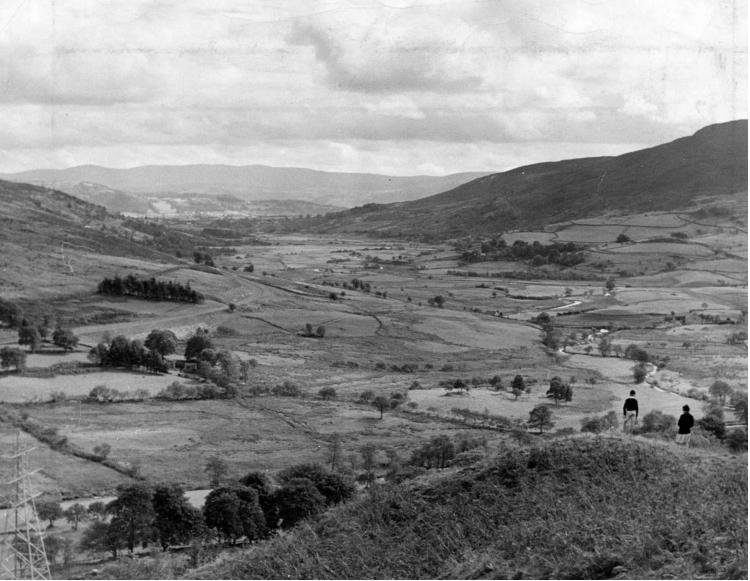
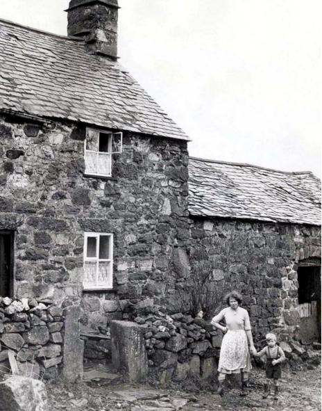
When the Tryweryn Valley, where the village was located, was flooded, the village and its buildings, including the post office, the school, and a chapel with cemetery, were all lost. A further 12 houses and farms were submerged, and 48 people of the 67 who lived in the valley lost their homes.
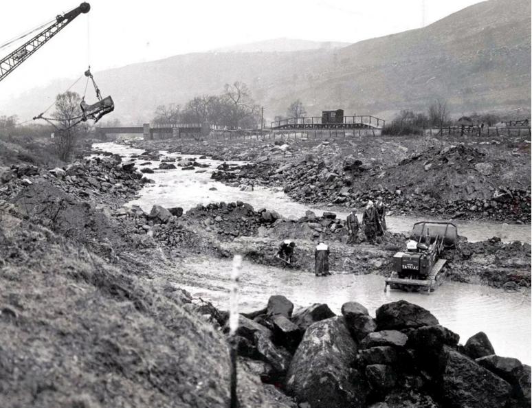
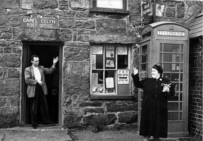
Capel Celyn, a village home to 67 people and one of the last Welsh-only speaking communities, stood in the Trweryn Valley which became the proposed site for the new reservoir. Rather than applying to local planning committees to build the reservoir, Liverpool City Council sponsored a bill in Parliament, meaning Welsh political opposition couldn't stop approval of the scheme, the ECHO previously reported.
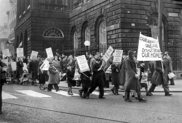
In 1957, a bill for the construction of the reservoir passed through the Houses of Parliament and was approved despite 35 of the 36 Welsh MPs voting against it. The end result was 800 acres and an entire village being flooded - and it triggered fierce opposition and a campaign of Welsh nationalist civil disobedience.
Families who had relatives buried in the village cemetery were given the option of moving the deceased to another location. The valley was eventually flooded in 1965 - and any evidence of its existence can only been seen during heatwave conditions when the reservoir dries out.
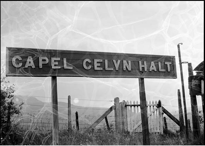
On October 19, 2005 Liverpool Council issued a formal apology for the flooding. While some in the neighbouring town of Bala welcomed the move, others dismissed it as a "useless political gesture" that came far too late.
After the flooding of the village the slogan 'cofiwch Dryweryn', which means 'remember Tryweryn', emerged as a prominent slogan for Welsh nationalism as the event was used by some nationalists to call for independence.
Mardale Green and Measand
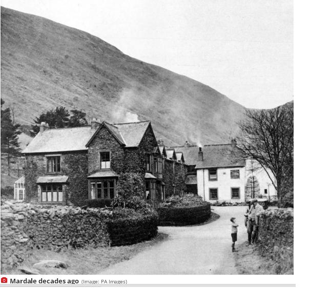
When the conditions are right, the remains of a village reappears. During particular hot spells, the 'drowned' village of Mardale Green surfaces from its watery grave like 'Atlantis,' the MEN previously reported.
In the 1930s, the picturesque Cumbrian villages of Mardale Green and Measand were submerged to create what's now known as the Haweswater reservoir. It was one of the largest reservoirs in England, meant to supplement the water from Thirlmere reservoir with the intention of supplying Manchester with drinking water for a hundred years.
The controversial construction of the Haweswater dam in the Lake District started in 1929 after Parliament passed an Act giving Manchester Corporation permission to build the reservoir to supply water for the urban conurbations of northwest England. At the time, there was a public outcry about the decision as the planned site of the reservoir was populated by the farming villages of Measand and Mardale Green.
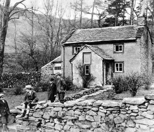
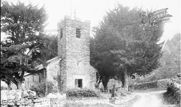
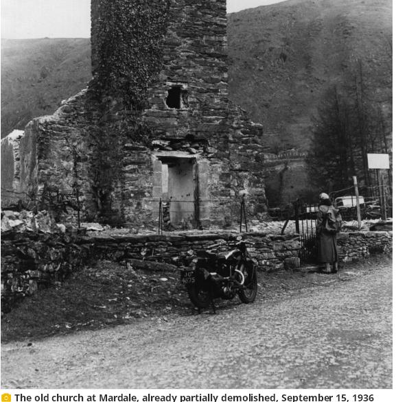
homes, as well as 97 bodies removed and re-buried in a graveyard in the nearby village of Shap.
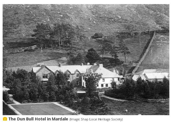 The farms and houses of the villages of Mardale and Measand, and the well-loved Dun Bull Inn apparently famous for its hot buttered rum, was a great loss to the wider community. It was popular for miles around with farming families and hunting folk who gathered there for fairs, feasts, dances and sales throughout the year were demolished and submerged by the reservoir in the 1930s, when a prolonged period of hot weather occurs the water level can sink to such an extent that it's possible to walk among its ghostly remains. During times of drought the remnants of Mardale Green, including dry stone walls and an old bridge, can become visible.
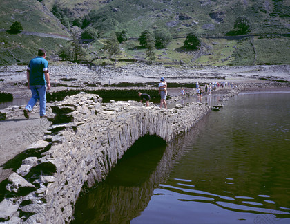 The last time the village showed itself was in July 2022, when a drought hit and water levels plunged.
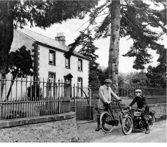 Also to be submerged by deepening Haweswater as a reservoir for Manchester the manor house of the Mardale neighbourhood Measand Beck Hall.
When the conditions are right, the remains of a village lost to supply Manchester with water reappears. During particular hot spells, the 'drowned' village of Mardale Green surfaces from its watery grave like 'Atlantis.'
Also to be submerged by deepening Haweswater as a reservoir for Manchester the manor house of the Mardale neighbourhood Measand Beck Hall.
When the conditions are right, the remains of a village lost to supply Manchester with water reappears. During particular hot spells, the 'drowned' village of Mardale Green surfaces from its watery grave like 'Atlantis.'
Derwent and Ashopton
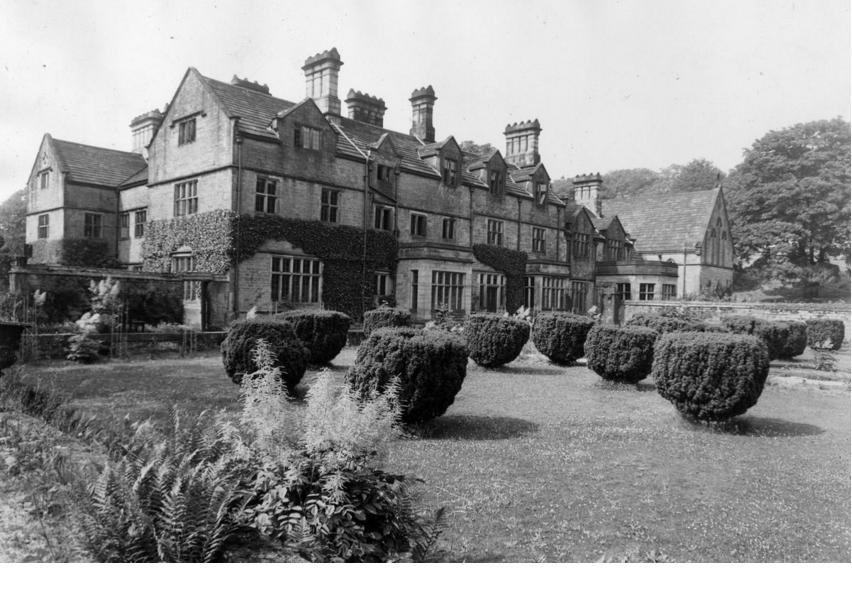
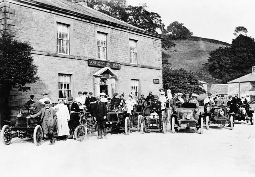
Ladybower Reservoir is a well-known tourist spot to those familiar with the Peak District. The picturesque man-made lake was built in the Upper Derwent Valley between 1935 and 1943 - the largest in the UK at the time. But the building of the reservoir came at a great cost - the bustling villages of Ashopton and neighbouring Derwent. Both villages which nestled high in the Peak District were lost forever
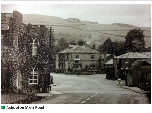
Bodies were exhumed from graveyards, a local church held its final service. The buildings that once made up these thriving villages were reduced to nothing but rubble.
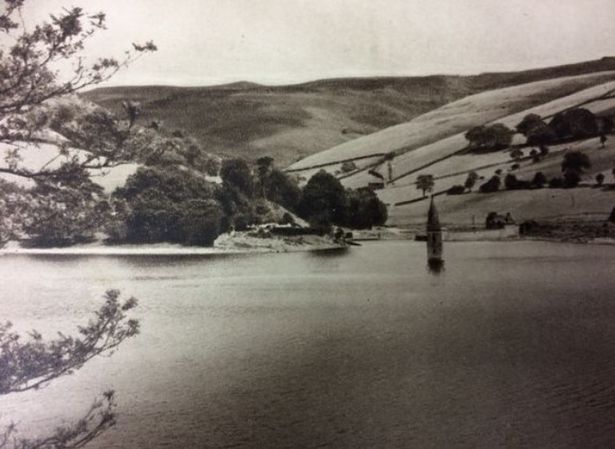
As the dam filled, the crumbling ruins disappeared beneath millions of gallons of water, never to see the light of day again. All that remained was an untouched spire from the church of St John and St James, kept as a memorial for Derwent villagers.
For over a year it poked out of the water, posing as a haunting reminder of what once was. But when that too was demolished and vanished beneath the sheet of blue, no memory was left of the lost villages.
That was until heatwaves hit the country in 1976, 1989, 1995, 2003 and 2018. Low water levels meant the villages emerged in a rare occurrence, offering visitors an eerie glimpse into its past.
During dry spells, a walk around the village community can still find signs of life beneath the water, including cottage doorways, walls, hearths, pump houses and bricks.
Greenbooth
(Image: Colin Park / geograph.org.uk)
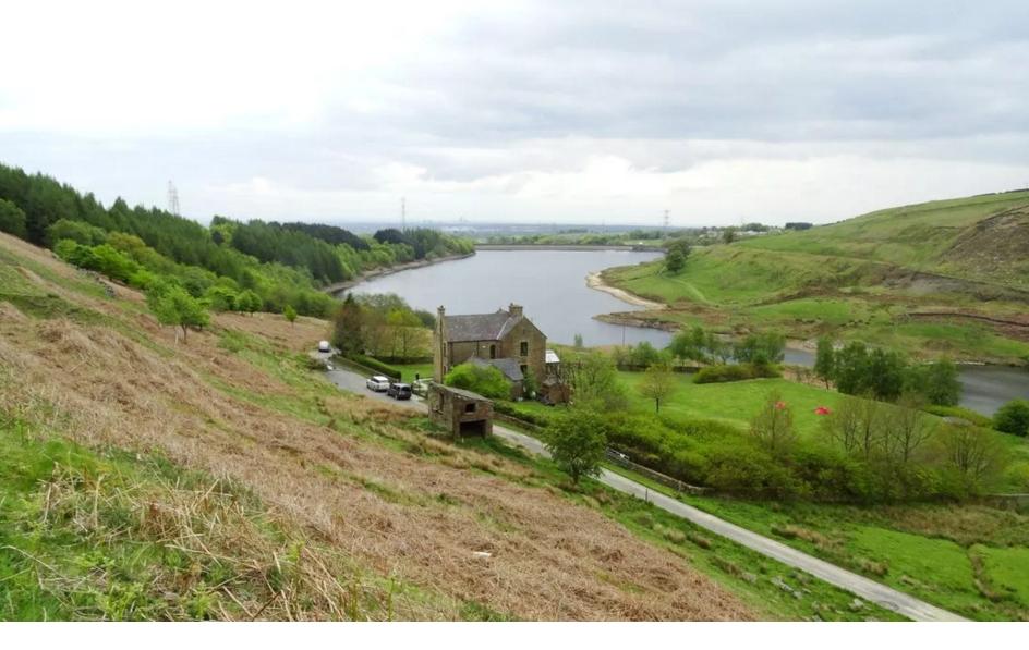
Six decades on, haunting memories of how the historic Norden village of Greenbooth became submerged under millions of gallons of water are still remembered by those who lived there. It was flooded in the early 1960s, after four years of construction, to create the last in a series of four reservoirs in the Naden Valley.Today, Greenbooth Reservoir is an essential part of the beautiful countryside north of Heywood, visited by dog walkers, hikers and nature lovers.
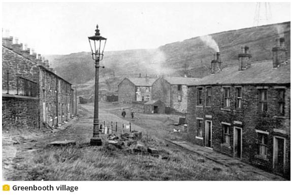
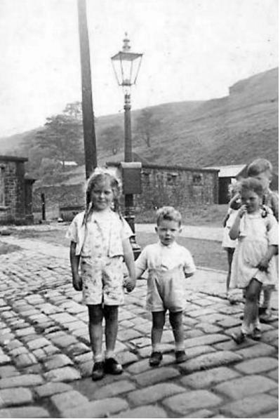
The area was known as Green Booth when James Butterworth established a weaving mill there in the 1840s. Fed by local coal, it produced woollen flannel for clothing manufacturers across the north of England. While it seems quaint and bucolic now, the 'new' village Butterworth established - which became known by the single word Greenbooth - was cutting edge for the time. With rows of terraces, a little school, and bigger homes for managerial staff, Butterworth was providing accommodation and a community for his workers, with rent and milk money deducted straight from their wages.
However there was no church, or pub, in the 19th century village of Greenbooth. And by 1911 it had lost its heart. The plans to submerge the valley it sat in were confirmed in 1955 and the village was finally empty not long after. When it was demolished there were 46 houses left in the village, 20 of which were derelict.
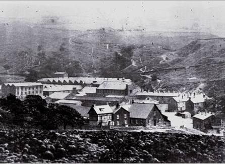
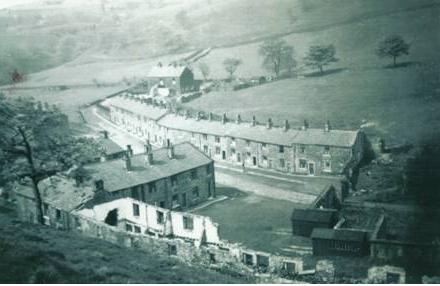
The reservoir, measuring 40 metres high and 300 metres long was completed in 1963, and officially opened in August 1965.
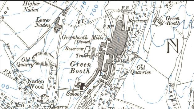
click for clearer map
more at :
https://www.manchestereveningnews.co.uk/news/greater-manchester-news/lost-greater-manchester-village-thats-21041680
https://www.heywoodhistory.com/2012/10/the-lost-world-of-green-booth.html
Watergrove
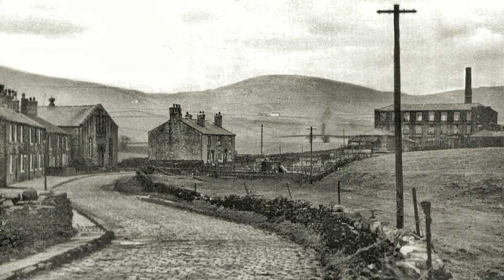
click for large pic
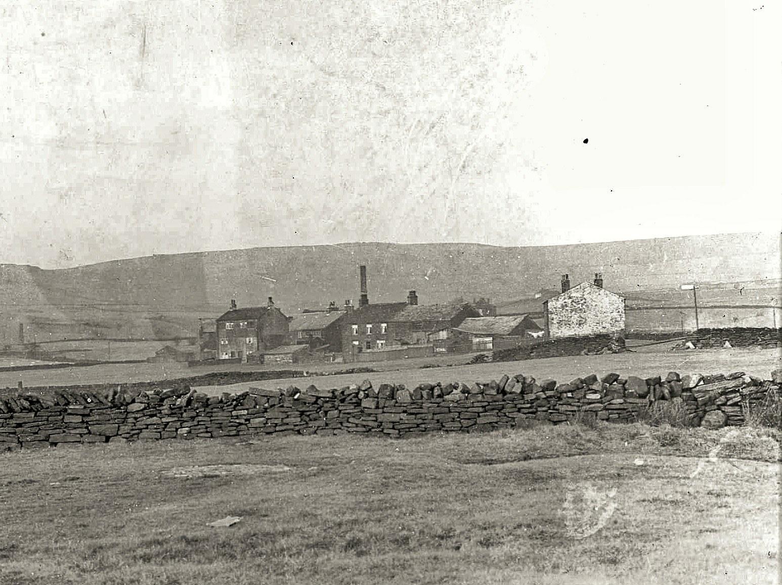
In the 1920s, to solve Rochdale's desperate shortage of drinking water, the council decided to build a reservoir by flooding the valley north of Wardle where the village of Watergrove had existed for nearly 700 years.
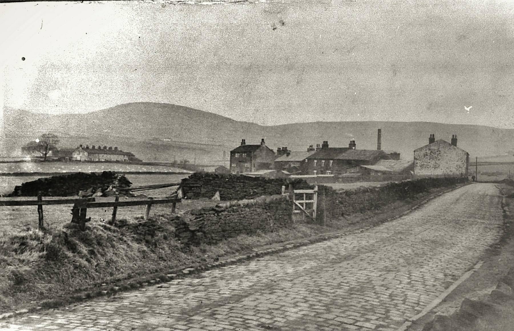
click for very large pic
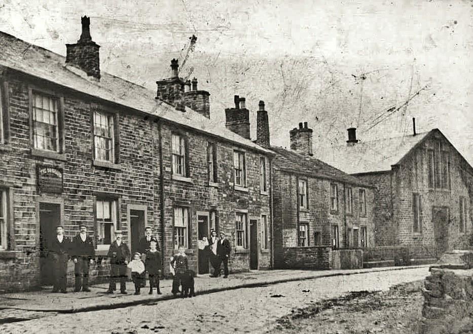
The Watergrove United Free Methodist Church was built in 1852 and its baptismal register showed 616 births between 1854 and 1933, in 1930 there were nearly 50 houses, two pubs, a smithy, two mills and a thriving chapel, but by the depression in the 1920s the population had dropped to below 200.
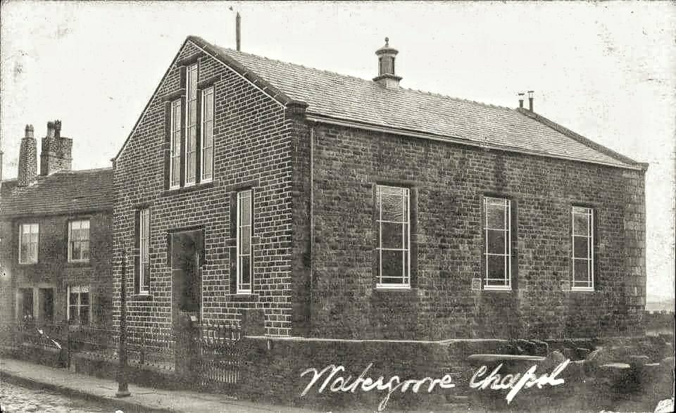
click for large pic
There were two clear streams, Wardle Brook and Higher Slack, which the village used and which also interested Rochdale Council in 1930. They were short of water and there was also a lot of unemployment in the area. Their solution was to flood the valley, provide water and generate employment. The only losers were the local people and Watergrove was to be flooded.
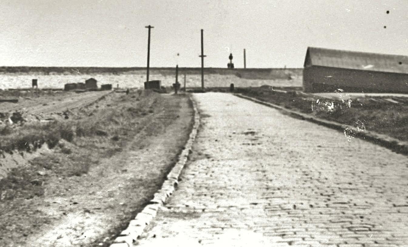
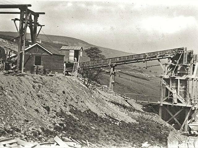
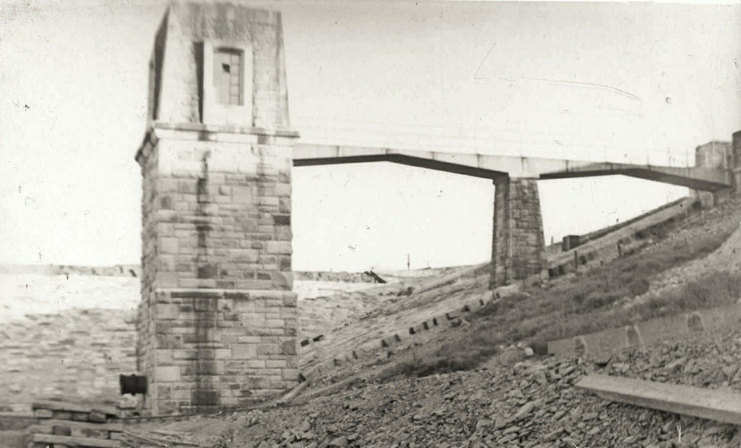
Parliament approved Rochdale Council's application to build a reservoir at Watergrove and work began in June 1930. Some villagers resented the decision and one wrote in Lancashire dialect to the chief engineer at Watergrove saying people should use less water.
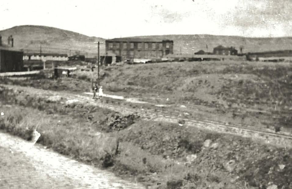
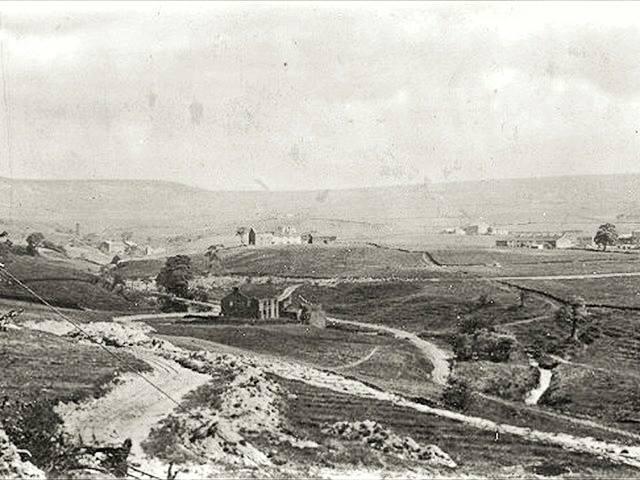
Today Watergrove is a popular destination for watersports, horse riding, orienteering and walking and family day trips.
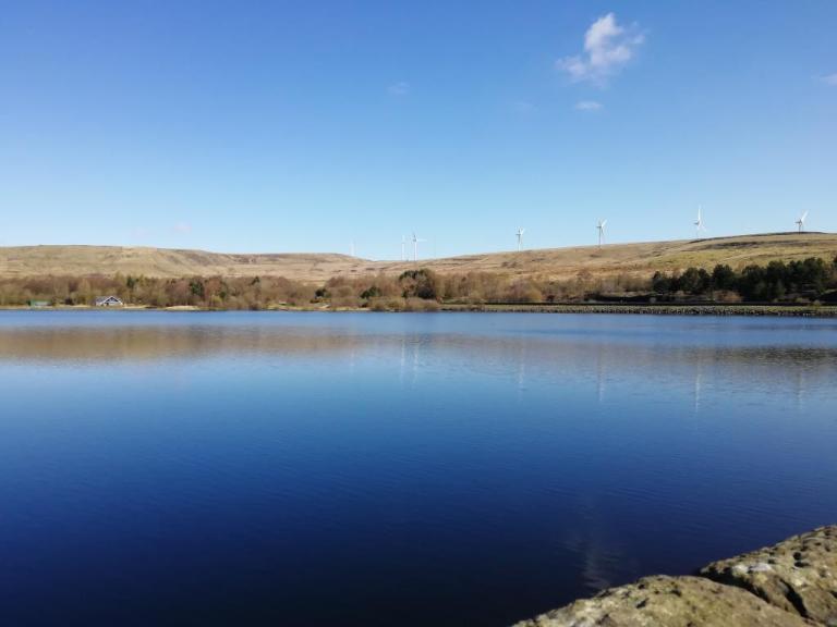
At the moment North West Water is developing the nature trails and has provided a splendid bird hide overlooking the water and several of the old workings and quarries have been landscaped to produce ponds which in the summer are a riot of colour. In the winter wildfowl and waders are worth travelling miles to see.
At Watergrove there is a display of photographs of the old village. it is between Hollingworth and Rochdale, just off the A58, turn off the main road at the village of Wardle itself a cul-de-sac , right at the end of this and along a cobbled path is Watergrove a taste of forgotten Lancashire.
The site is not well-signed but the locals love it and so do I. There is plenty of parking and along the circular path around the reservoir is a neat visitors' centre, picnic tables and toilets.
© Rochdale-Observer
© www.liverpoolecho.co.uk/news/nostalgia/lost-abandoned-ghost-villages
© www.manchestereveningnews.co.uk
© A.N.Other.
