Peak District hiking trail that takes you to remains of WW2 bomber crash,The Boeing B-29 Bomber crash in the Peak District claimed the lives of all 13 crew members, but the remains of the wreckage can still be seen today alongside a hiking trail
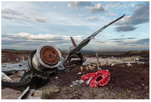
A hiking trail in the Peak District boasts a unique feature - the remnants of a plane that crashed in 1948. The aircraft in question is a B-29 Bomber, a U.S. Air Force Superfortress.The plane met its tragic end in the British countryside during a domestic flight between UK bases. The wreckage can be found approximately an hour from the nearest parking facilities, near the remote Snake Summit.
It's worth noting that the hike to the site is quite challenging and may not be suitablefor beginners or those planning to bring children along.While the remains of the bomber offer an intriguing sight, the story behind them is a sombre one, as all those aboard the flight perished in the crash
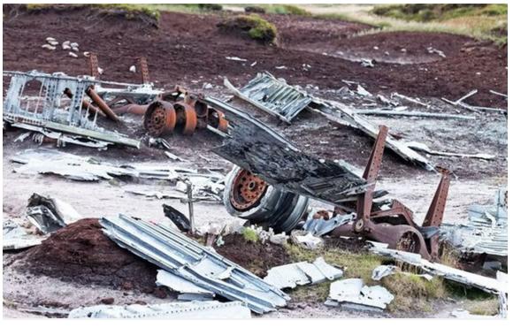
The accident was caused by poor visibility due to cloudy weather. The pilots began their descent, mistakenly believing they had already cleared the hills. At 11am on 3rd November 1948, the aircraft struck the ground and burst into flames. It wasn't until the plane failed to arrive at Burtonwood airbase at its scheduled time that the crash was suspected.
The crash site was eventually located at 16:30, and the bodies of those onboard were recovered the following morning.The Boeing B-29 Superfortress was an American four-engined propeller-driven heavy bomber designed by Boeing and primarily used by the United States during World War II.
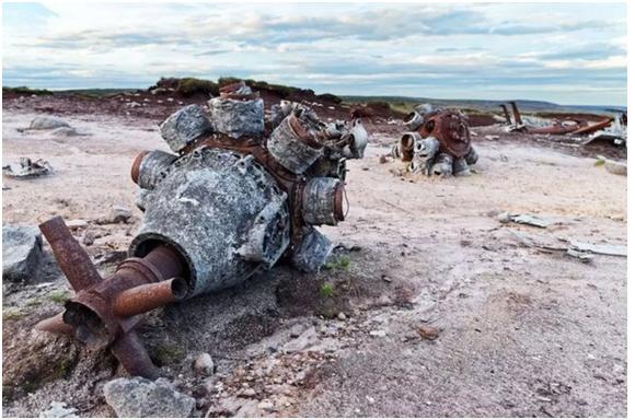
Several challenging hiking trails lead to the crash site, as mentioned on the Peak District's official website.Hikers are advised to park at either Snake Summit or Doctor's Gate Culvert, which is roughly a one-hour walk away from the aircraft remains.
For those who prefer a longer trek, parking at Torside is available, but be prepared for a four-hour hike. This route is only recommended for hikers who are experienced and fully equipped for such an endeavor.
The platform AllTrails also offers several suggested paths. Three of these are designated as hard, with one route taking five hours and 19 minutes, another lasting four hours and 57 minutes, and the third six hours and 12 minutes.

Explore the history of the B29 Crash site, a historic reminder of the airmen who tragically lost their lives in service to their country.This remarkable hike offers stunning views over Manchester and reveals haunting yet captivating remnants of the mangled wreckage.So, lace up your boots and get ready as we cover everything you need to know before your visit!
The crash site near Higher Shelf Stones is located just outside Manchester, within the Peak District, and a short distance from Glossop.For this hike, we'll begin at the Snake Pass summit, which is accessible only by car.If you need to use public transport, consider starting your walk from Glossop or Torside, though this will result in a longer route.
Parking at Snake Pass Summit
Parking is primarily available along the summit of Snake Pass Road (A57). However, spaces can be limited on busy days, so be sure to arrive early.Snake Pass Road Side.
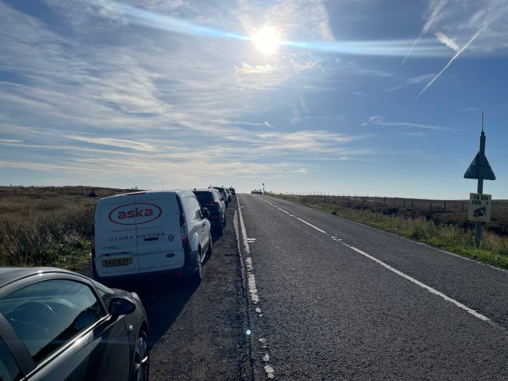
Address: Snake Pass Summit, Pennine Way, Sheffield SK13 7PQ
If the main parking is full, there are a few additional spots further down the road at what3words ( ///remains.defrost.caged ), though availability is limited. Be careful not to park behind the double yellow lines, as it's common for cars to receive tickets in this area.
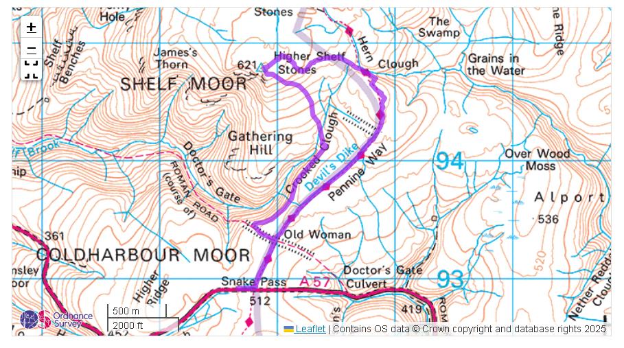
Start from Snake Road, following the Pennine Way before veering off the main path and heading towards the Higher Shelf Stones trig point, which offers stunning views over Manchester. A short distance away is the main B29 "Overexposed" crash site wreckage. From there, you can return to the Pennine Way and follow it back to the main road.
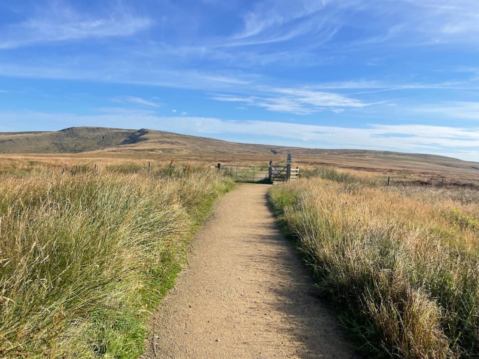
1. Head down the path from Snake Road, which is part of the famous Limestone Way, and go through the gate.
2. A short distance along the path, turn left onto the "Doctors Gate" footpath.
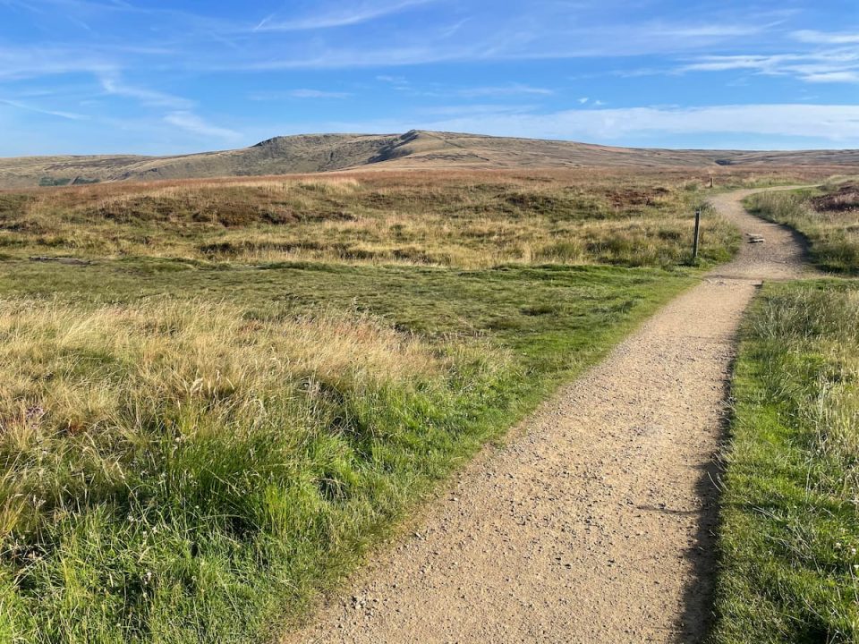
Note: The trail can become boggy from this point on. If the weather is particularly bad, consider doing this walk counterclockwise, sticking to the Pennine Way as much as possible, and returning the same way.
3. When you reach a sharp bend in the path, take a right and follow the side of the valley towards the waterfall.
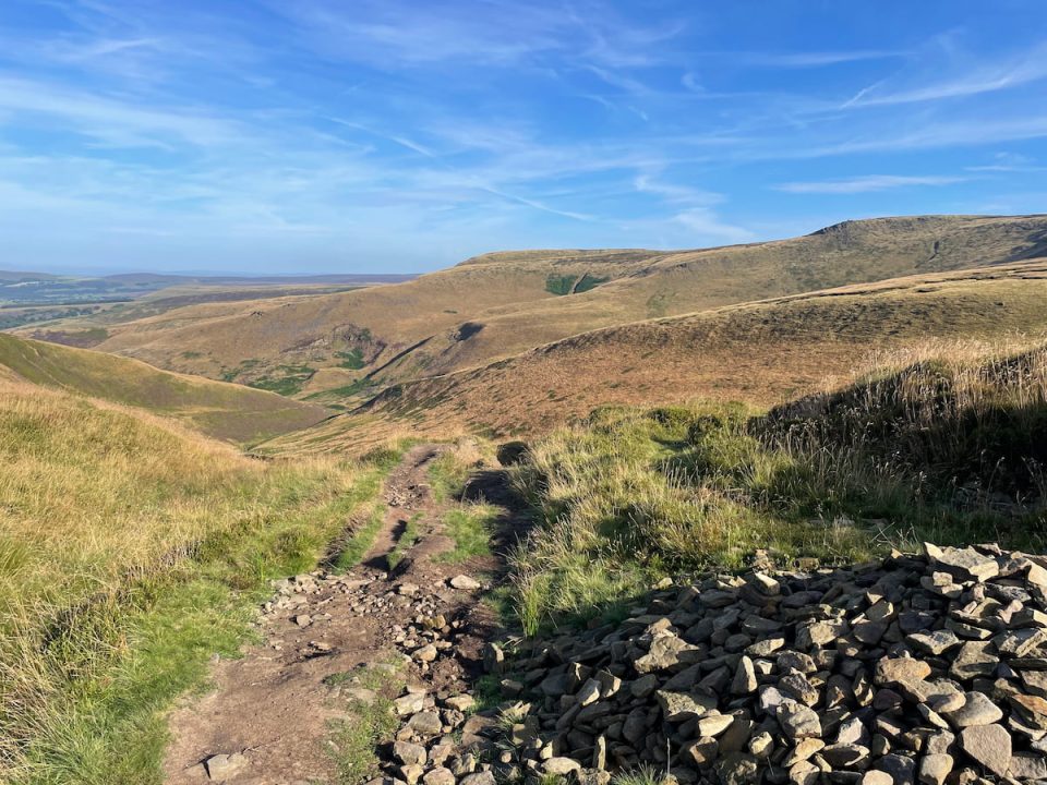
4. At the ford, turn left, cross over the stream, and head uphill towards the Higher Shelf Stones trig point. Don't worry - this is the steepest part!
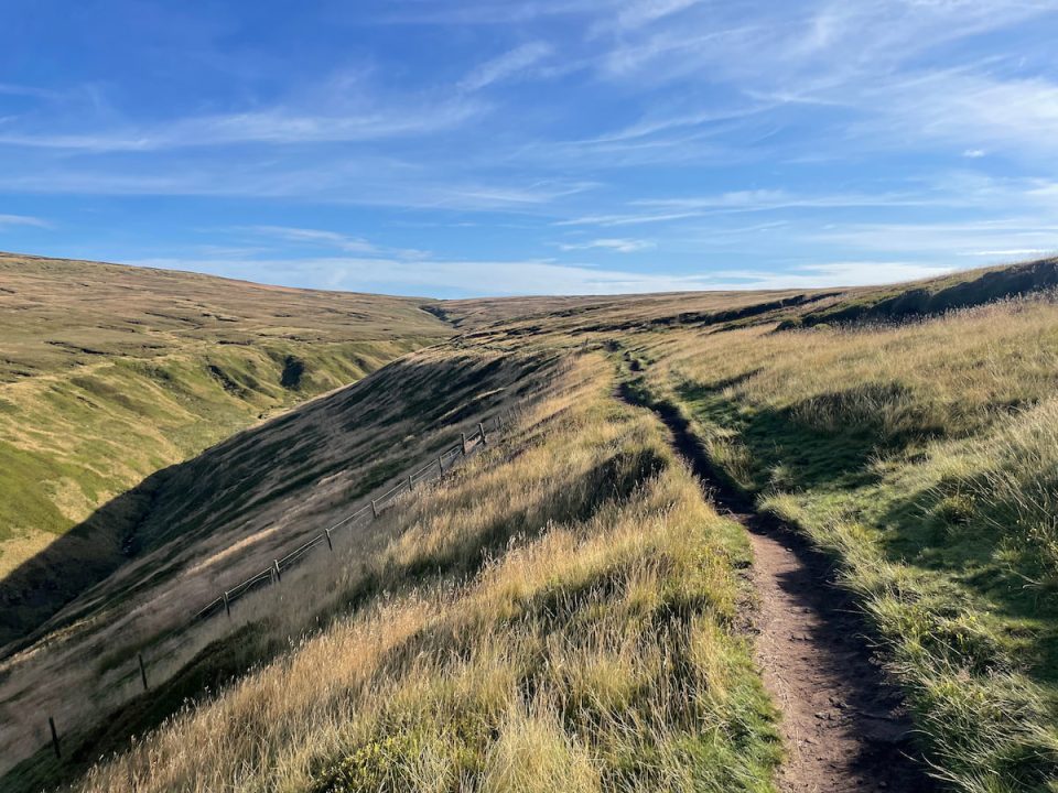
Note: I recommend using a GPS alongside your paper map here, as it's easy to get lost. There are many paths in the open moorland, and sheep tracks can be misleading, so stay attentive. GPS file here
5. You are now at the trig point of Higher Shelf Stones. On a clear day, this spot offers the best views of the area, including a panoramic view over Manchester.
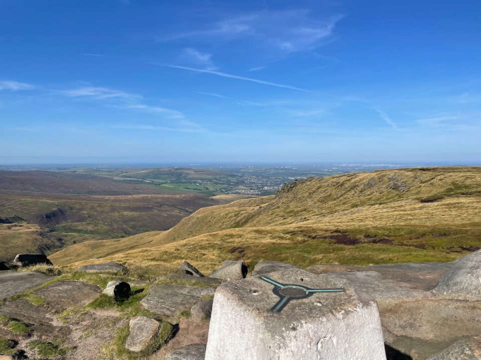
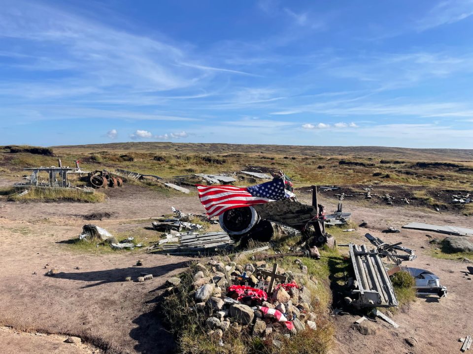
6. Continue from the far side, and after a short distance, you'll reach the main crash site. When I last visited, an American flag and poppies placed by visitors were nestled among the wreckage, which includes parts of the aircraft such as the Duplex-Cyclone engines, wing sections, fuselage sections, undercarriage, and gun turrets.
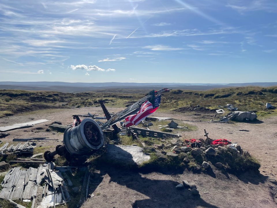
Note: It should go without saying, but please do not attempt to take souvenirs or move parts of the wreckage. Many visitors come here to pay their respects at the memorial. This is an undisturbed crash site, so be aware that much of the metal has sharp edges that could cause injury.
7. Continue following the path, passing various plane parts along the way, until you rejoin the Pennine Way at "Hern Clough."

8. Follow the Pennine Way all the way back to the main road via Devil's Dyke, where you started the walk.

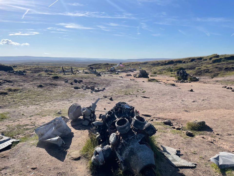
The B-29 Superfortress, named "Over Exposed," met its tragic end on November 3rd, 1948, on the moorlands of Bleaklow near Higher Shelf Stones, in the Peak District. This aircraft, a modified reconnaissance version of the iconic bomber, was part of the 16th Photographic Reconnaissance Squadron, flying under the Strategic Air Command of the USAF. Originally built in Renton, Washington, it had served during World War II and participated in atomic bomb testing at Bikini Atoll.
On the day of the crash, the aircraft was en route from RAF Scampton in Lincolnshire to the US Air Force base at Burtonwood, carrying a crew of 13 and a $7,400 payroll. Flying in poor visibility due to low clouds, the crew mistakenly believed they had crossed the hills and began descending. Unfortunately, they were still seven minutes short of clearing the high ground, resulting in a collision with the rugged terrain of Bleaklow. The crash instantly claimed the lives of all on board.
The Bleaklow moors have seen several tragic military aircraft crashes over the years. Below is a summary of these incidents:
30th January 1939: Bristol Blenheim Mk.I L1476
Crew: Pilot Stanley John Daly Robinson and Passenger Jack Elliott Thomas (Both Killed)
Location: Sykes Moor, Bleaklow
Incident: The aircraft nose-dived during a training flight from RAF Church Fenton, resulting in the deaths of both crew members. The crash site was discovered two weeks later by a walker. A memorial was erected in 1991.
29th August 1941: Boulton Paul Defiant Mk.I N3378
Crew: Pilot James Craig and Passenger George Daniel Hempstead (Both Killed)
Location: Bleaklow Stones, Bleaklow
Incident: The aircraft crashed at cruising speed in low cloud while returning from RAF Turnhouse to RAF Hibaldstow. The wreckage was found by shepherds nearly a month later after a search by ten aircraft failed to locate it.
10th December 1941: Blackburn Botha Mk.I W5103
Crew: Pilot Thomas William Rogers (Killed)
Location: Round Hill, Bleaklow
Incident: The aircraft crashed during a flight from Blackburn Aircraft's factory to Harwarden. The pilot descended through low cloud before clearing the hills, leading to the crash.
5th December 1956: De Havilland Canada L-20A Beaver52-6145
Crew: Pilot John Rossman Tinklepaugh, Passenger Guy Waller (Both Killed)
Location: Bramah Edge, Bleaklow
Incident: The aircraft crashed during a flight from RAF Sculthorpe to RAF Burtonwood due to an air traffic control error that mistakenly directed the plane into the hillside.
These incidents highlight the treacherous nature of the Bleaklow moors, particularly in poor weather conditions, and serve as solemn reminders of the challenges faced by aircrews during these periods.
Make sure you're prepared for your next walk. Here are some of the essentials: Daypack: Choose a 10-20L daypack to carry all your gear comfortably.
Clothing: Wear layered, moisture-wicking clothing and pack a waterproof jacket and waterproof trousers for changing weather.
Footwear: Sturdy walking boots or trail shoes are essential for the varied terrain.
Water & Snacks: Carry enough water (at least 1L per hour) and bring energy-rich snacks.
Navigation: Always have a map and compass, and optionally, bring a reliable GPS app to stay on track.
First Aid Kit: Include essential items like blister treatments and painkillers. A compact First Aid Kit is ideal.
Emergency Items: A headtorch, whistle, and multi-tool can be vital in unforeseen situations.
This is just a short overview, but I would also recommend watching the brilliant guide from Buxton Mountain Rescue.Please note some of these links may earn us a commission from qualified purchases at no additional cost to you, which helps fund the free content we provide.
B29 Crash Site Amenities & Facilities There are no amenities near the bomber crash site, so be sure to bring everything you need with you and take it back with you, leaving no trace.
The closest town is Glossop, just a 7-minute drive away, located just outside the Peak District National Park. It offers plenty of pubs, local cafes, and a Tesco Extra for all your other needs.
Here are some popular options in the town:
The Globe: A legendary pub is known for its vegan food, home-brewed beers, and music venue.
Glossop Cafeteria: This great, affordable cafe is known for its hearty English breakfasts.
Napoli Restaurant: Popular authentic A La Carte Italian Restaurant
Canella: An artisan coffee house serving great coffee, cakes, and the occasional alcoholic beverages.
©:Alex Hesp-Gollins
